|
|
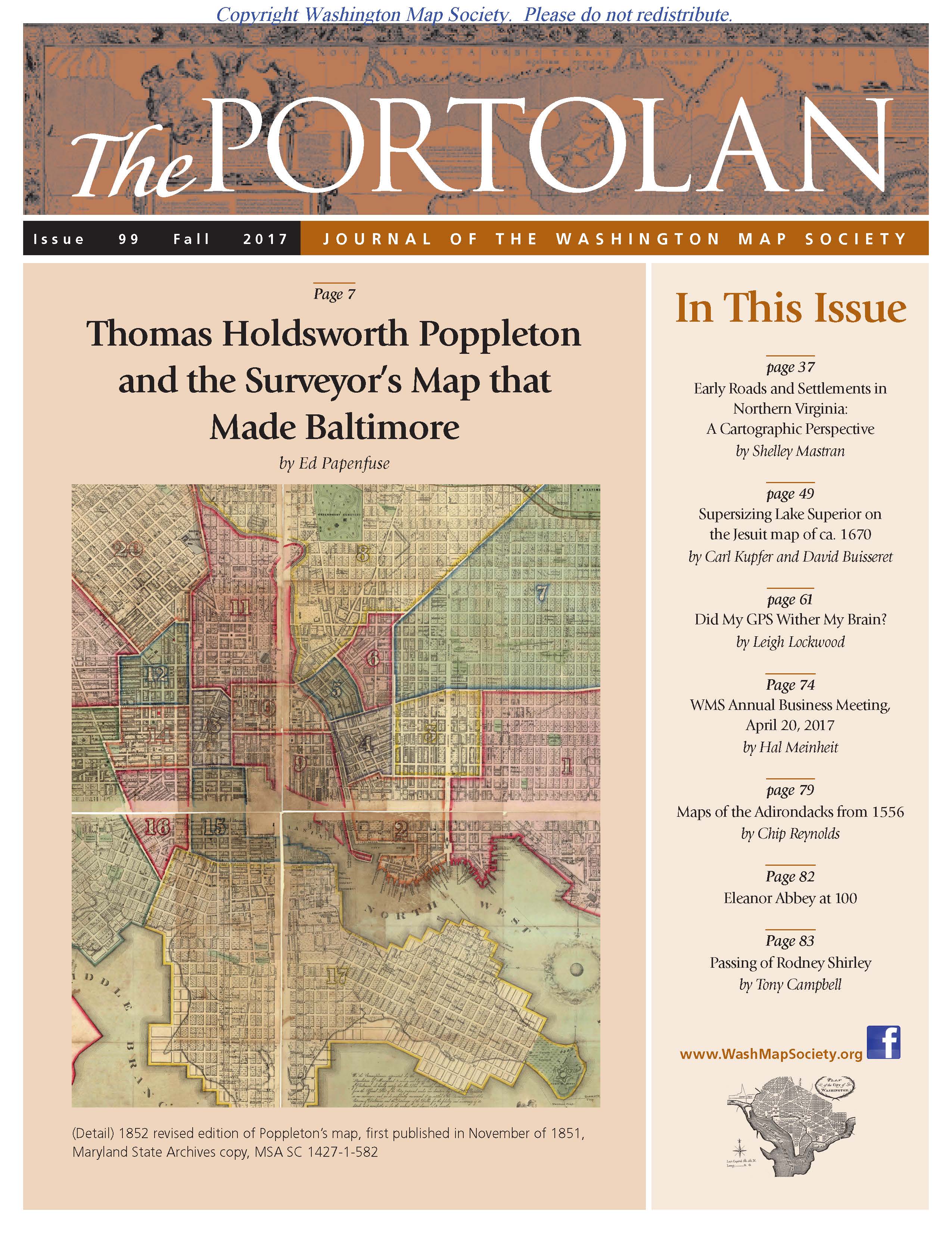
The Portolan Issue #99 - Fall 2017 ARTICLES Thomas Holdsworth Poppleton and the Surveyor's Map that Made Baltimore by Ed Papenfuse Early Roads and Settlements in Northern Virginia: A Cartographic Perspective by Shelley Mastran Supersizing Lake Superior on the Jesuit map of ca. 1670 by Carl Kupfer and David Buisseret Did My GPS Wither My Brain? by Leigh Lockwood RECENT PUBLICATIONS This regular feature, a bibliographic listing of articles and books appearing worldwide on antique maps and globes and the history of cartography, is compiled by Joel Kovarsky. BOOK REVIEWS -Terrarum Orbis (TO 13) Vincenzo Coronelli Cosmographer (1650-1718) (Reviewer: Richard Pflederer) -Antipodes – In Search of the Southern Continent (Reviewer: Henry Steward) -The Nine Lives of John Ogilby – Britain’s Master Map Maker and His Secrets (Reviewer: Peter Porrazzo) -Explorers of the Maritime Pacific Northwest – Mapping the World through Primary Sources (Reviewer: Michael Layland) -Monaco Autrefois (Reviewer: Bert Johnson) -Treasures from the Map Room: A Journey through the Bodleian Collections (Reviewer: Cassandra Britt Farrell) SHORTER ITEMS 1. President’s Fall 2017 Letter 2. Washington Map Society Meetings: September – December 2017 3. Exhibitions and Meetings 4. Map Site Seeing 5. Ristow Prize Competition 2018 6. WMS Annual Business Meeting, April 20, 2017, by Hal Meinheit 7. WMS Annual Dinner, May 25, 2017, by Thomas Sander 8. Field Trip to National Museum of the American Indian, by Daniel Cole 9. Parts But Little Known: Maps of the Adirondacks from 1556, by Chip Reynolds 10. Spotlight on the WMS Membership – Michael Buehler, Ralph Ehrenberg, Bob Kibbee, Bob Hansen 11. Eleanor Abbey at 100 12. Passing of Rodney Shirley, by Tony Campbell 13. Cartographic Notes, by Thomas Sander |
© 2021 Washington Map Society. All Rights Reserved. |
|