|
|
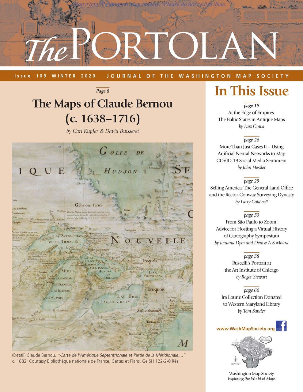
The Portolan Issue #109 - Winter 2020
ARTICLES The Maps of Claude Bernou (c. 1638-1716), by Carl Kupfer and David Buisseret At the Edge of Empires: the Baltic States in Antique Maps, by Lars Grava More Than Just Cases II - Using Artificial Neural Networks to Map COVID-19 Social Media Sentiment, by John Hessler Selling America: The General Land Office and the Rector-Conway Surveying Dynasty, by Larry Caldwell From São Paulo to Zoom: Advice for Hosting a Virtual History of Cartography Symposium, by Jordana Dym and Denise A S Moura Ruscelli’s Portrait at the Art Institute of Chicago, by Roger Stewart Ira Lourie Collection Donated to Western Maryland Library, by Tom Sander RECENT PUBLICATIONS This regular feature, a bibliographic listing of articles and books appearing worldwide on antique maps and globes and the history of cartography, is compiled by Leah M. Thomas BOOK REVIEWS The Intellectual Profile of Elisha ben Abraham Cresques (1325-1387) (Reviewer: Dick Pflederer) The Indies of the Setting Sun: How Early Modern Spain Mapped the Far East as the Transpacific West (Reviewer: Hal Meinheit)
SHORTER ITEMS 1. WMS President’s Winter 2020 Letter 2. Announcement of Winner, 2020 Ristow Prize Competition 3. Nearly a Quarter Century as Portolan Editor, by Thomas Sander 4. Introducing Dr. Leah Thomas, new Editor-in-Chief, by Thomas Sander 5. Washington Map Society Meetings: Winter 2020/2021 6. Exhibitions and Meetings 7. Map Site Seeing 8. Ristow Prize Competition 2021 9. Cartographic Notes, by Thomas Sander
|
© 2021 Washington Map Society. All Rights Reserved. |
|